Route planning Pilot
Build and save routes with airports, waypoints, airways, route candidates, preferred routes, altitude/timing context, alternates, and an active map line.

Capabilities by workflow
ClearRoute features are organized around what the pilot is trying to understand. Product, tier, and release-state labels show where each capability belongs.
Available is verified in current product evidence. In testing is not yet a public promise. Planned describes the intended launch structure.
Plan the flight
Build and save routes with airports, waypoints, airways, route candidates, preferred routes, altitude/timing context, alternates, and an active map line.
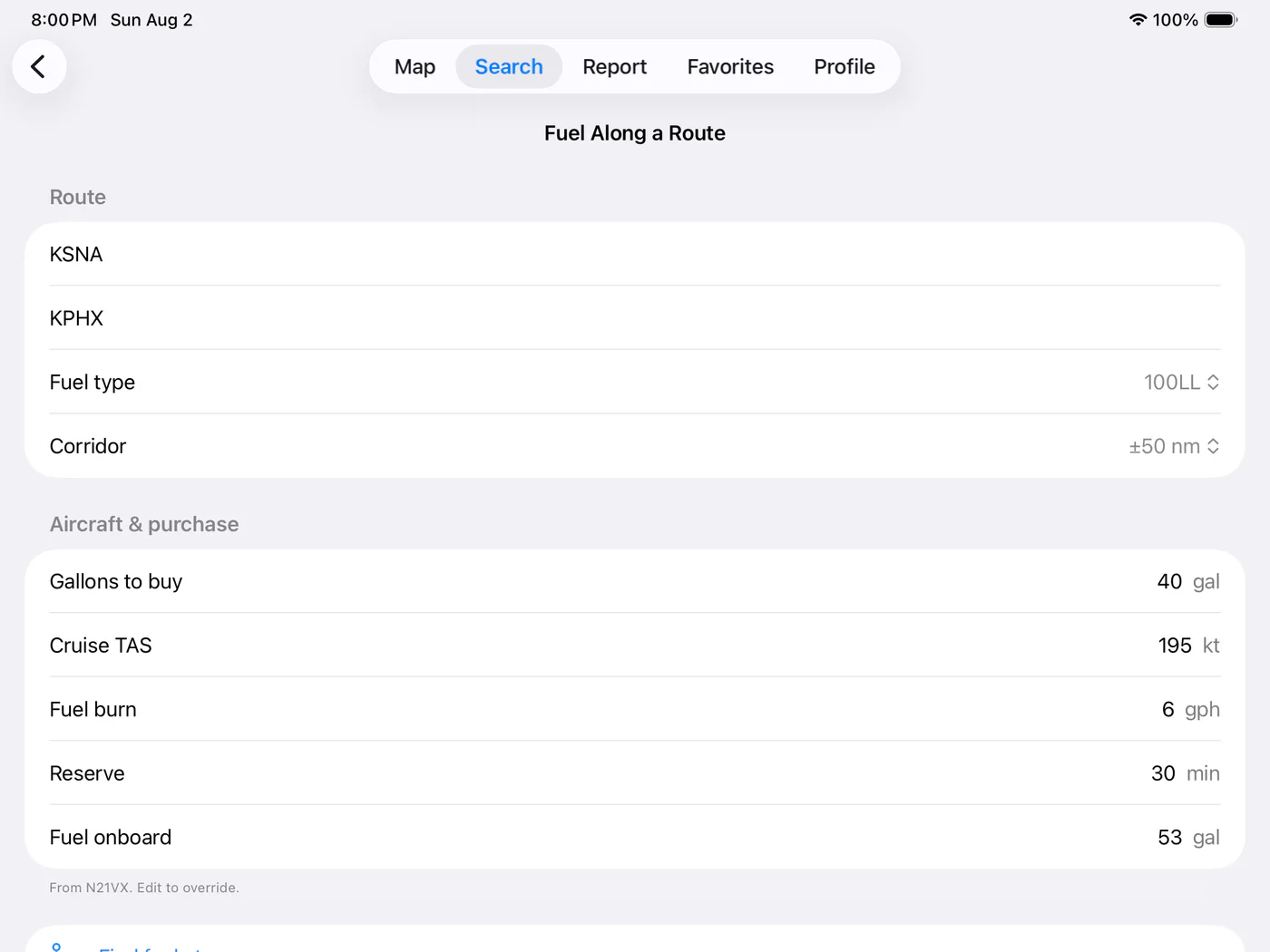
Use pilot-entered aircraft profiles for fuel planning, weight and balance, takeoff/landing performance, glide range, and endurance range.
Review an advisory synthesis of corridor weather, hazards, alternates, and route context. Raw and official sources remain part of the pilot’s review.
Drafting, validation, and the filing interface exist, but public claims about live FAA transmission wait for production-provider verification.
Understand the route
Procedure minima remain excluded from public copy until the data source and shipped client behavior are confirmed.
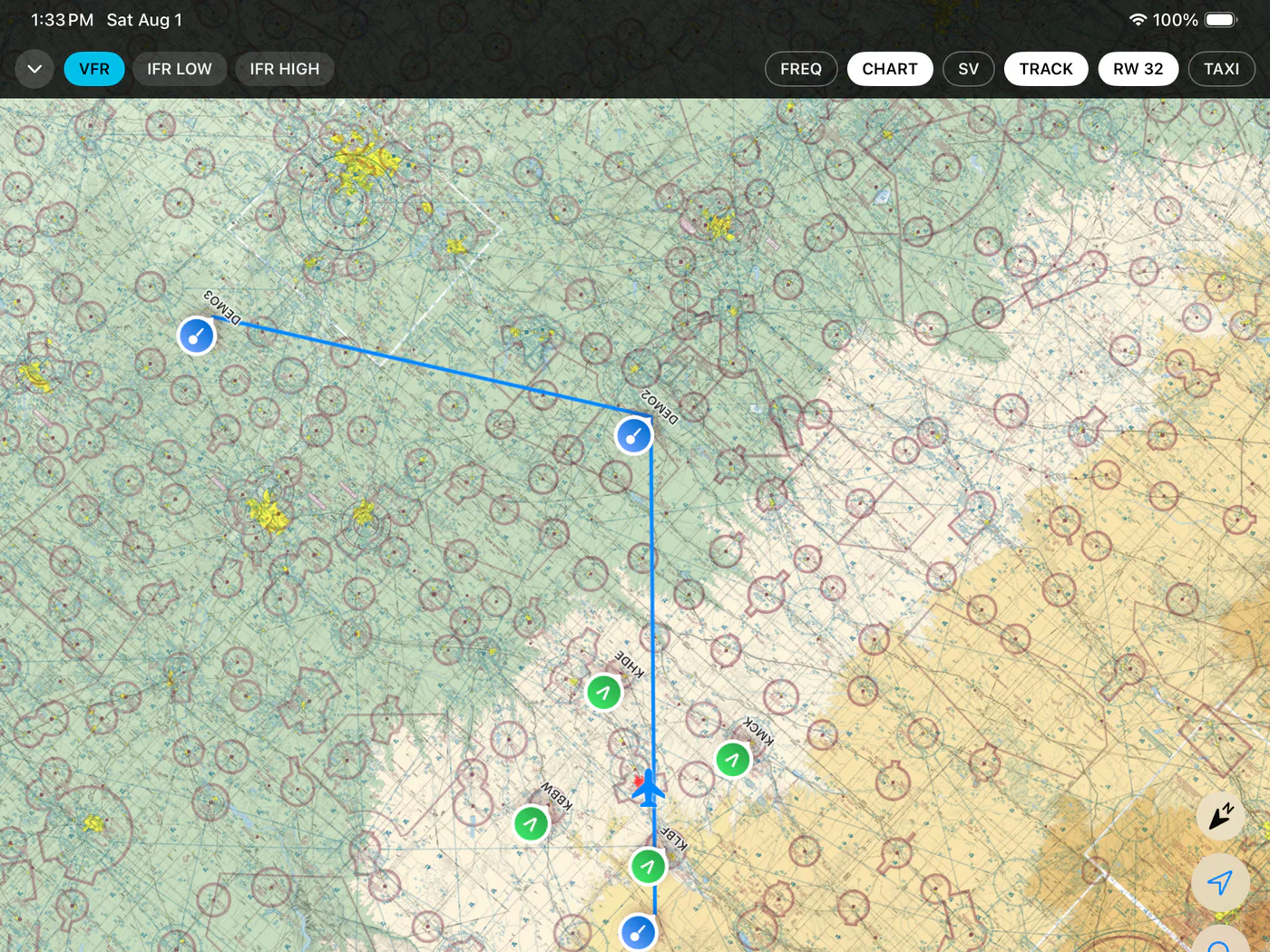
Evaluate weather and radar
Decoded and raw METARs, TAFs, winds aloft, PIREPs, SIGMETs, AIRMETs, and airport weather context.
An animated NOAA composite radar loop over the selected chart, with age and time controls.
Deeper radar products, Level II imagery, rotation tracks, and an advisory AI evaluation of movement and trend.
Delayed advisory weather from a compatible 978 UAT receiver. Do not use it for tactical weather decisions.
FAA camera imagery matched to nearby airports for additional observed-condition context.
Compare planning conditions with the ceiling, visibility, wind, night, and marginal-VFR limits you set.
Choose a fuel stop
Always confirm prices and services with the FBO. Fuel Pro launch surfaces and Pilot entitlement remain subject to final release confirmation.
Prepare, monitor, and record
GDL 90 receiver status, ownship, and traffic on supported Apple devices. Named receiver compatibility requires final publication confirmation.
3D terrain, runway, obstacle, and traffic context with advisory terrain presentation. AHRS receiver validation remains a separate release-state question.
Entries, currency, qualifications, endorsements, tracks, cloud sync, and CSV/PDF/JSON export. Read and export access remains after subscription lapse.
The launch matrix includes per-aircraft checklists, while the current web client still identifies them as coming soon. Publication waits for confirmation.
Choose a product
Use Pilot for the complete flight-planning and records workflow. Use Fuel for fuel discovery and trip economics.
Every chart, data product, calculation, and AI output is supplemental to official sources, approved equipment, and pilot judgment.